
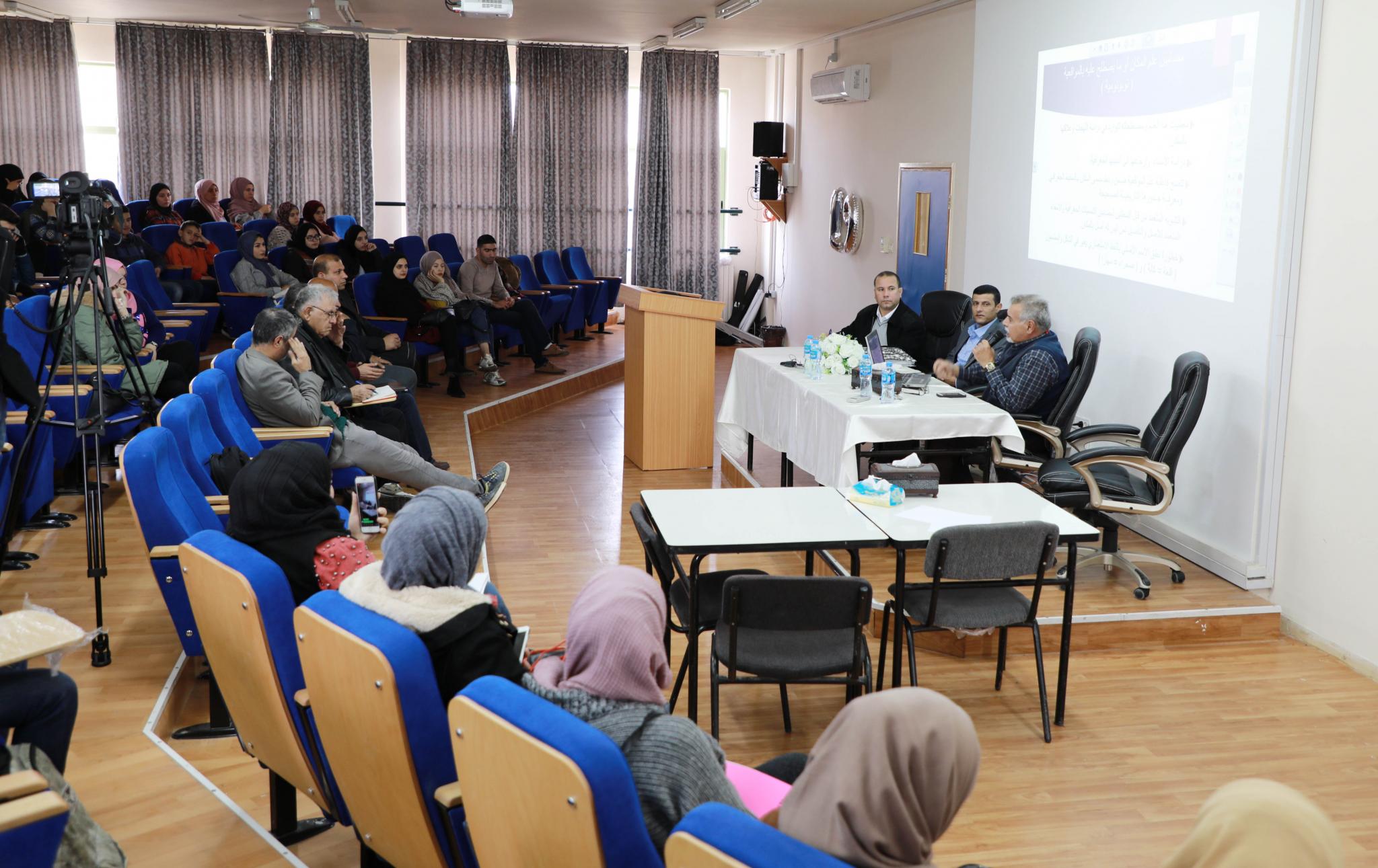
The Geographical Information Systems Department GIS at the Faculty of Engineering and Information Technology at the University held a specialized seminar about geographical names in Palestine, presented by members of the National Committee for Geographical Names the Professor of Social and Historical Geography from Al-Quds University Dr. Fayez Freihat, and acting director of the Palestinian Geographical Center from the Ministry of Transportation and Communication Mr. Bashar Hamayel, in the presence of a group of teachers and students from Geographic Information Systems Dept.
The seminar was opened by Dr. Faisal Sabah Head of the GIS Department at the University. The seminar emphasized the importance of this seminar in enhancing the students' knowledge of the importance of geographical names in Palestine and linking them to GIS systems and their future role in harnessing what they learned in the service of this important sector in Palestine. Which expresses the identity and belonging since the adherence of the names is part of the adherence of the land and history.
He explained that GIS Department at the university focuses on the modern applied aspects in geographic information systems, and provides student with the skills in how to deal with techniques regarding geographic information systems and its use in presenting, analyzing, and treating with geographic information, and taking advantage of the modern techniques in geographical studies to serve and develop contemporary societies, and provide specialized staffs needed by the labor market in decision support units.
In his speech Professor Fayez Freihat a professor of social and historical geography from Al-Quds University, said: "The Israeli occupation authorities have not only taken control of the Palestinian territories and stole them, but is striving to change its geographical features, in an attempt to falsify historical facts of the identity of the Palestinian land. After its occupation of the remaining Palestinian territories in 1967, it continued the policy of Judaization of Palestinian territories, and in this regard came its campaign to Judaize the names of Palestinian geographical features in a way history hasn’t ever recorded.
He added that the occupation authorities have tried to obliterate all traces of the Palestinian Arab identity in the country and the connection of Palestinian people to their lands by changing the names of hundreds of religious and archaeological sites, streets, neighborhoods and historic buildings, in addition to the names of lands, hills and mountains especially in Jerusalem and gave them Hebrew and biblical names of Israeli leaders that have nothing to do with these places and distributed the Palestinian territories with settlements and bypass roads which became Hebrew names, this poses a very serious challenge not only to the Arab Palestinian presence in the country but also to the nature of civilization and historical memory
Dr. Freihat pointed out the importance of the names of places and geographical features, assuring that it is the historical identity of the place and the clear indication of its cultural identity, which must be preserved and entrenched as it carries in its contents and implications a clear reflection of the cultural heritage for the Palestinians and the ancient connection with their homeland throughout history.
As he said that the Palestinian government in 2010 formed the National Committee for Geographical Names in order to preserve the national identity, protect the cultural and historical heritage, determine the reference of all geographical names, prepare a database for this purpose and work continuously to complete the Palestinian dictionary of geographical names.
The Acting Director of the Palestinian Geographical Center at the Ministry of Transportation and Communication, and member of the National Committee for Geographical Names Mr. Bashar Hamayel, confirmed that the committee began its work from the Ministry of Planning and at the time it was on English maps issued by the British Mandate government before the occupation of Palestine in 1948, The team assigned at that time collected the names from the English maps and computerized there was about 25 thousand name, and doing work fields to the places and sites in all regions, and after the abolition of the Ministry of Planning the file of geographical names moved to the Ministry of Education Which was added to the Geomolg system, and then in the National Committee we checked the names by word and meaning.
He warned the Palestinian citizens inadvertent of transferring the Israeli names to instead of the Palestinian names, assuring that this has very serious consequences towards the Palestinian cultural heritage and the Palestinian places and presence. He explained that the committee is in the final stages of producing the Atlas, which will contain 20,000 names. As he assured that universities are one of the most institutions that we must work with in this regard because it brings together all Palestinian citizen and the ability to communicate with the university students to check the names and adding new ones.
The Atlas will be distributed to all international institutions and bodies, especially the United Nations to establish and strengthen the Palestinian right to the names of places, villages, mountains, valleys and historic places in Palestine.
At the end of the seminar, many questions were raised regarding geographical names and the mechanisms of dealing with the occupation, which seeks to falsify, distort and steal names and call them Jewish Israeli names.
Most Read
AAUP Faculty of Nursing Holds a Scientific Research Day for its Students
Arab American University Participates in a Specialized Training Program Titled "Quality in Higher Education: From Methodology to Institutional Excellence"
Arab American University Student Defends Her Master's Thesis in Quality Management in Healthcare Institutions
AAUP Chairman of Board of Directors Congratulates Mr. Hussein Al-Sheikh on Appointment as Vice Chairman of the Executive Committee of the Palestine Liberation Organization
Weather
AAUP
, Palestine
The Tangible Temperature 23
To install AAUP WEATHER application on smartphones


Add new comment