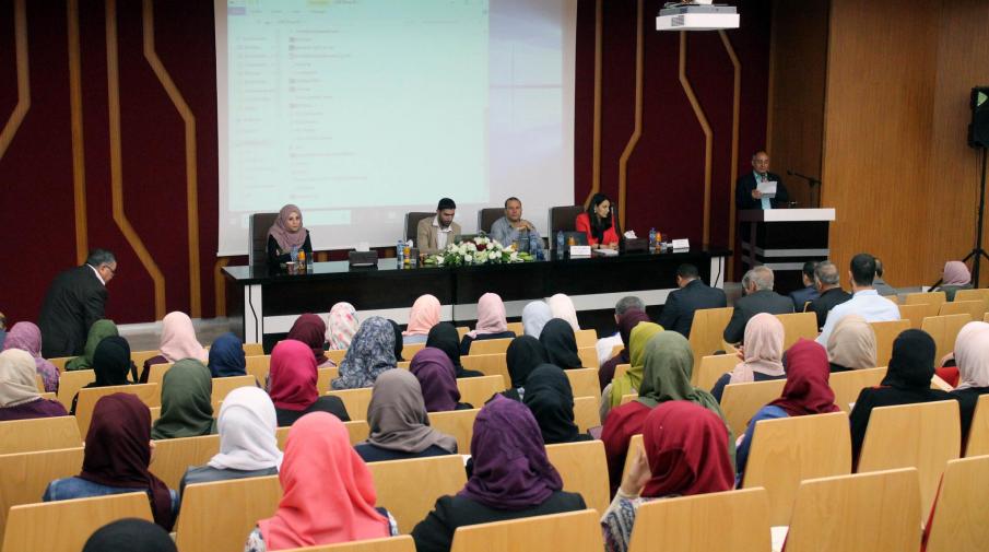
The Faculty of Engineering and IT at the Arab American University organizes a geographical information systems day, where some organizations related to the specialization participated, to enhance the GIS department students’ experience.
From the Event
The opening session attended by Acting Dean of the Faculty of Engineering and Information Technology Dr. Mujahid Aliyat, Head of Geographic Information Systems Department Dr. Jacqueline Abu Daoud, representatives of Palestinian universities in the West Bank, representatives of some ministries and related institutions and municipalities in the West Bank and the 1948 lands, the Arab American University academic and administrative staff and students of the University GIS Department.
In the Dean of the Faculty of Engineering and Information Technology speech, Dr. Mujahid Aliat said: “Four years ago, the University launched a unique discipline at national level, which is the Geographic Information Systems Specialization. It has been successful and distinguished”. Pointing some of the presented projects in today’s activities are the students' products after four years study, and by the end of the current semester they will be the department first batch of graduates who’s ready to join the labor market.
He explained, the world today is in a technology race with the uses and diverse applications of technology, and maps technology is one important application. The Arab American University is committed to providing the Palestinian labor market with its needs of specialists in this field. Stressing that the university is determined to move forward to develop this program and follow its global improvements.
Dr. Jacqueline Abu Dawood, Head of the GIS Department at the Arab American University expressed their pride to celebrate the fourth anniversary to launch this program and celebrate graduating this specialization’s first batch of students. Stressing that the students will benefit from the experience of the hosted institutions who works with geographic information systems.
She emphasized the importance of having the GIS department at the Faculty of Engineering and Information Technology to upgrade the department with geographic information, programming, analysis, and programming applications. This is what we will see in the graduation projects that will be presented during today's activities. Stressing the importance of students joining practical training with institutions to know the challenges they’ll face in the labor market.
The day’s events included two sessions that included cultural and educational lectures and some papers. During the first session, the representative of the Water Authority Ashraf Dweikat presented a paper entitled “Linking the water databases with geographic information systems”, while the representative the Department of Meteorology Issam Issa paper title was “Continuous efforts to link Palestinian Meteorological Data with GIS”.
In the second session, Good Shepherd Company representative Hanna Yunan presented a paper entitled “Collaboration in Using GIS, Open Data, and Computerized Maps.” While the Ministry of Local Government representative, Jumana Abu Sada, presented a paper entitled “The Use of GIS in Integrated Cities and Urban Development,” and the title of Prof. Yousef Jabarin paper, urban planning expert from the 1948 Palestinian Territory, was “Using GIS as a Militant and Community Tool.”
The events included presenting the Department of Geographic Information Systems students graduation projects at the Arab American University, a roundtable to discuss the cooperation prospects with partner institutions, and the activities concluded by honoring participants, guests, and graduate students.

